Grindleford is a village and civil parish in the county of Derbyshire, in the East Midlands of England. The population of the civil parish as taken at the 2011 Census was 909. It lies at an altitude of 492 feet (150 m) in the valley of the River Derwent in the Peak District National Park. The 17th-century Grindleford Bridge crosses the river on the western side of the village.
On the west side of the valley is the 1,407 feet (429 m) high Sir William Hill, and to the south-east lies the gritstone escarpment of Froggatt Edge. Grindleford became a parish in 1987, merging the parishes of Eyam Woodlands, Stoke, Nether Padley and Upper Padley.
The nearest city to Grindleford is Sheffield, the centre of which is about 12 miles (19 km) away. For rail travellers, the Sheffield suburb of Totley is less than four miles away at the other end of the Totley Tunnel, the second-longest rail tunnel in the UK. Grindleford railway station (actually located in Upper Padley, half a mile away from the village) is at the western portal of the rail tunnel, on the scenic Hope Valley Line between Sheffield and Manchester.
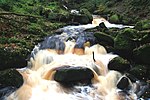
Grindleford is popular with walkers and climbers due to its proximity to a variety of landscapes, including open moorland, wooded river valleys (including Padley Gorge), several gritstone escarpments, and the broad Hope Valley. Visitors seeking refreshment are well catered for by a number of establishments, including the Sir William Hotel, the Maynard Hotel and Bar, the National Trust Longshaw Estate Visitor Centre, and Grindleford Station Cafe (in the old station house).


