place

Military Park Building

Historic district contributing properties in Newark, New JerseyNew Jersey building and structure stubsOffice buildings completed in 1926Skyscraper office buildings in Newark, New Jersey
Military Park Building, Newark, New Jersey

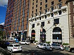
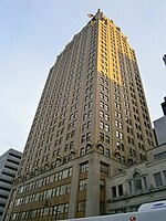
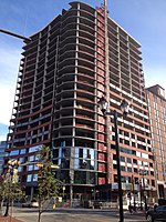
The Military Park Building in Newark, New Jersey is one of the earliest skyscrapers built downtown. Designed by the architectural firm Polhemus & Coffin of New York, it was the tallest building in New Jersey upon its completion in 1926 until being surpassed in 1930 by the Eleven 80. The landmark takes its name from nearby Military Park. Also nearby are some of the city's most prominent institutions such as Newark Museum, New Jersey Performing Arts Center, Newark Public Library, New Jersey Historical Society and Rutgers University. It is served by the Military Park (NLR station). The Military Park Building is owned by the Newark-based Berger Organization, which acquired it in late 2007. Berger previously had been a minority partner in the 250,000-square-foot, 21-story building. Renovations completed in 2010 upgraded the lobby, core building and elevators, and introduced a fitness center and conference room for tenants. That project also established street-level retail accessible from both outside and within the building.

Excerpt from the Wikipedia article Military Park Building (License: CC BY-SA 3.0, Authors, Images).

Military Park Building
Park Place, Newark

Geographical coordinates (GPS) Address Nearby Places
placeShow on map

Wikipedia: Military Park BuildingContinue reading on Wikipedia

Geographical coordinates (GPS)

Latitude Longitude
N 40.7385 ° E -74.169333333333 °
placeShow on map

Address

Park Place News

Park Place
07101 Newark
New Jersey, United States
mapOpen on Google Maps

Military Park Building, Newark, New Jersey
Share experience

Nearby Places

Newark Public Service Terminal

The Public Service Terminal was a three-level streetcar station in Newark, New Jersey, owned and operated by the Public Service Corporation, adjacent to the Hudson and Manhattan Railroad's Park Place station. It served as the terminus for streetcar lines from as far as Trenton. Public Service was both a transportation company and a utility, providing electric and gas service to much of northern New Jersey. The six office stories above the terminal served as company headquarters. The terminal, opened on April 30, 1916 was located at the northeast corner of Park Place and Raymond Boulevard at Military Park, a few blocks away from the busy downtown crossing at Broad and Market Streets. It provided an off-street terminal for streetcars, and a central location for riders. The street entrance was between the two track levels, and provided access to the office floors and to both terminals. Most cars used the upper level, reached by a ramp from Mulberry Street on the east side. Some used the lower level, reached on the west side from Washington Street by a two-block Cedar Street Subway. In 1916 the upper level saw 2,050 cars a day and the lower 550 cars, with more than 50,000 fares paid per day. In 1935 the lower level was connected to the newly built City Subway, which ran under Raymond Boulevard adjacent to the terminal, to allow cars to continue to the subway terminal at Penn Station. The eastbound connection passed under the City Subway to avoid a grade crossing. Like most trolley companies, Public Service converted its routes to bus lines during the 1930s. The last streetcar line using the terminal upper level was the #1-Newark line to Exchange Place Terminal in Jersey City, which ended on August 1, 1937. The last on the lower level was the #43-Jersey City line, running to Exchange Place Terminal by a different route, which ended on May 1, 1938. The terminal continued in use for bus routes. The lower level was used until May 1966, and the upper level until 1978. Public Service sold its transportation system to the New Jersey Transit in 1981, consisting of a large network of bus lines and one trolley line, the City Subway. The terminal building was demolished in June 1981 and replaced with the Public Service Enterprise Group headquarters, 80 Park Plaza. The unused Cedar Street Subway from the portal to a wall east of Broad Street still exists. The City Subway tunnel has become part of the Broad Street branch of the Newark Light Rail, emerging at Centre Street.

Newark Public Schools

Newark Board of Education is a comprehensive community public school district that serves students in pre-kindergarten through twelfth grade in the city of Newark in Essex County, New Jersey, United States. The state took over the district in 1995 -- the third takeover statewide -- and returned control in 2018, after 22 years. The district is one of 31 former Abbott districts statewide that were established pursuant to the decision by the New Jersey Supreme Court in Abbott v. Burke which are now referred to as "SDA Districts" based on the requirement for the state to cover all costs for school building and renovation projects in these districts under the supervision of the New Jersey Schools Development Authority.As of the 2020–21 school year, the district, comprised of 63 schools, had an enrollment of 40,423 students and 2,886.5 classroom teachers (on an FTE basis), for a student–teacher ratio of 14.0:1.The total school enrollment in Newark city was 75,000 in 2003. Pre-primary school enrollment was 12,000 and elementary or high school enrollment was 46,000 children. College enrollment was 16,000. As of 2003, 64% of people 25 years and over had at least graduated from high school and 11% had a bachelor's degree or higher. Among people 16 to 19 years old, 10 percent were dropouts; they were not enrolled in school and had not graduated from high school.The district is classified by the New Jersey Department of Education as being in District Factor Group "A", the lowest of eight groupings. District Factor Groups organize districts statewide to allow comparison by common socioeconomic characteristics of the local districts. From lowest socioeconomic status to highest, the categories are A, B, CD, DE, FG, GH, I and J.