Kocher

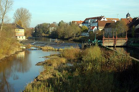
The Kocher (German pronunciation: [ˈkɔxɐ] ) is a 169 km (105 mi)-long right tributary of the Neckar in the north-eastern part of Baden-Württemberg, Germany. The name "Kocher" originates from its Celtic name "cochan" and probably means winding, meandering river. Its total drainage area is 1,960 km2 (760 sq mi). The Kocher rises in the eastern foothills of the Swabian Alb from two karst springs, the Schwarzer (black) Kocher and the Weißer (white) Kocher, that join in Unterkochen near Aalen. The Schwarzer Kocher is approximately 8 km (5.0 mi) long. Its source discharge varies between 50 L/s and 4,000 L/s with an average of 680 L/s. The 3.3 km (2.1 mi) long Weißer Kocher has an average discharge of 400 L/s.
Excerpt from the Wikipedia article Kocher (License: CC BY-SA 3.0, Authors, Images).Kocher
Schacht-König-Wilhelm-II., Verwaltungsgemeinschaft Bad Friedrichshall
Geographical coordinates (GPS) Address Nearby Places Show on map
Geographical coordinates (GPS)
| Latitude | Longitude |
|---|---|
| N 49.222777777778 ° | E 9.2019444444444 ° |
Address
Kocherspitze
Schacht-König-Wilhelm-II.
74177 Verwaltungsgemeinschaft Bad Friedrichshall, Kochendorf
Baden-Württemberg, Germany
Open on Google Maps


