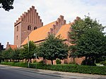
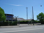
Amagerbrogade

Amagerbrogade is the main shopping street and thoroughfare of the part of Copenhagen, Denmark that is located on the island of Amager . It begins at the end of the causeway which connects Amager to Christianshavn and the city centre on the other side of the harbour, and runs south until it reaches the municipal border with Tårnby where it continues as Amager Landevej. The street marks the border between Amager Vest and Amager Øst, two of the ten official districts of Copenhagen. Amagerbrogade arose when the country road leading in and out of Copenhagen's Amager Gate was urbanized towards the end of the 18th century after the city's old fortifications had been decommissioned and the no-built zone outside them released. It is one of four such -bro streets.
Excerpt from the Wikipedia article Amagerbrogade (License: CC BY-SA 3.0, Authors, Images).Amagerbrogade
Amagerbrogade, Copenhagen
Geographical coordinates (GPS) Address Nearby Places Show on map
Geographical coordinates (GPS)
| Latitude | Longitude |
|---|---|
| N 55.650555555556 ° | E 12.612222222222 ° |
Address
Amagerbrogade 196
2300 Copenhagen
Capital Region of Denmark, Denmark
Open on Google Maps


