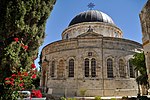
Street of the Prophets

Street of the Prophets (Hebrew: רחוב הנביאים, Rehov HaNevi'im) is an east–west axis road in Jerusalem beginning outside Damascus Gate and ending at Davidka Square. Located to the north of Jaffa Road, it bisects the neighborhood of Musrara. During its heyday in the late 19th century and early 20th century, Street of the Prophets was a favorite address for hospitals, churches, monasteries, hospices, government offices, foreign consulates, and wealthy Christian, Jewish and Muslim residents. Today the street still boasts the same heterogeneous mix of residents and workers, as well as schools, hospitals, churches and government offices. The elegant 19th-century architecture gives Street of the Prophets the appellation of "most beautiful street outside the Old City", while its historic buildings make it the most popular site for guided tours outside the Old City.
Excerpt from the Wikipedia article Street of the Prophets (License: CC BY-SA 3.0, Authors, Images).Street of the Prophets
HaNeviim, Jerusalem Morasha
Geographical coordinates (GPS) Address Nearby Places Show on map
Geographical coordinates (GPS)
| Latitude | Longitude |
|---|---|
| N 31.783888888889 ° | E 35.223333333333 ° |
Address
הנביאים
HaNeviim
9511208 Jerusalem, Morasha
Jerusalem District, Israel
Open on Google Maps


