Roskear
1905 establishments in EnglandCamborneCornwall County Cricket ClubCricket grounds in CornwallSports venues completed in 1905 ... and 1 more
Use British English from February 2023
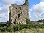
Roskear is a street and area on the eastern edge of Camborne, Cornwall. In the early 1900s, the area had a tram loop. Roskear is known in the 2000s mostly for its cricket ground, which is located off South Roskear Terrace. The ground is built on the site of the former North Roskear Mine, and is surrounded on all sides by housing. The ground has previously acted as a home ground for Cornwall County Cricket Club and has been the home of Camborne Cricket Club since 1905.
Excerpt from the Wikipedia article Roskear (License: CC BY-SA 3.0, Authors).Roskear
North Roskear Road,
Geographical coordinates (GPS) Address Nearby Places Show on map
Geographical coordinates (GPS)
| Latitude | Longitude |
|---|---|
| N 50.2213 ° | E -5.2881 ° |
Address
North Roskear Road
TR14 8PL
England, United Kingdom
Open on Google Maps


