Tuckingmill, Camborne, Cornwall
CamborneMining in CornwallVillages in Cornwall

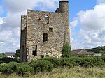
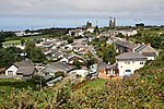
Tuckingmill (Cornish: Talgarrek, meaning hill-brow of a rock) is a village in Cornwall, England, United Kingdom, which is in the civil parish of Camborne. Tucking Mill (Cornish: Melyn Droghya, from the verb troghya) was the Cornish term for a fulling mill which was where homespun cloth was dipped, cleansed and dressed. There is a mention of a fulling mill in this region as early as 1250. The ecclesiastical parish of Tuckingmill was constituted in 1845, being carved out of a western section of the parish of Illogan and an eastern section of Camborne parish. It covers 1,300 acres (5.3 km2).
Excerpt from the Wikipedia article Tuckingmill, Camborne, Cornwall (License: CC BY-SA 3.0, Authors, Images).Tuckingmill, Camborne, Cornwall
Pendarves Street,
Geographical coordinates (GPS) Address Nearby Places Show on map
Geographical coordinates (GPS)
| Latitude | Longitude |
|---|---|
| N 50.222 ° | E -5.283 ° |
Address
Pendarves Street 78
TR14 8NP
England, United Kingdom
Open on Google Maps


