place

South Zone (Rio de Janeiro)

Neighbourhoods in Rio de Janeiro (city)Rio de Janeiro (state) geography stubs
Municipio Rio de Janeiro

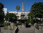
The South Zone (Portuguese: Zona Sul - Portuguese pronunciation: [ˈzonɐ ˈsuw]) is an area of the city of Rio de Janeiro situated between the Tijuca Massif, the Atlantic Ocean and Guanabara Bay. Most of it is made up of neighborhoods along the Atlantic coastline, such as São Conrado, Vidigal, Leblon, Ipanema, Copacabana, and Leme. It also includes the neighborhoods of Urca, Botafogo, Flamengo and Glória, on Guanabara Bay, and Santa Teresa, Catete, Laranjeiras, Cosme Velho, Humaitá, Lagoa, Jardim Botânico and Gávea, bordering on Tijuca Forest to the West or North. Zona Sul includes a number of favelas, such as Rocinha, close to São Conrado, Vidigal, close to Leblon, Cantagalo and Ladeira dos Tabajaras, in Copacabana, and Morro Dona Marta, in Botafogo. It is in this region that the majority of the city's balneario beaches and hotels are located, as are the Rodrigo de Freitas Lagoon, much of the Tijuca National Park, the Sugarloaf Mountain, with its cable car, the Corcovado hill, where the statue of Christ the Redeemer stands, and other natural wonders and tourist attractions. It is the richest region of the city and is visited by thousands of tourists from different parts of the world throughout the year.

Excerpt from the Wikipedia article South Zone (Rio de Janeiro) (License: CC BY-SA 3.0, Authors, Images).

South Zone (Rio de Janeiro)
Avenida Epitácio Pessoa, Rio de Janeiro Lagoa

Geographical coordinates (GPS) Address Nearby Places
placeShow on map

Wikipedia: South Zone (Rio de Janeiro)Continue reading on Wikipedia

Geographical coordinates (GPS)

Latitude Longitude
N -22.974199 ° E -43.199444 °
placeShow on map

Address

Sonata da Lagoa

Avenida Epitácio Pessoa 2664
22471-003 Rio de Janeiro, Lagoa
Rio de Janeiro, Brazil
mapOpen on Google Maps

Municipio Rio de Janeiro
Share experience

Nearby Places

General Osório Square

General Osório Square (Portuguese: Praça General Osório) is a square in Ipanema, Rio de Janeiro, Brazil. The square is bordered to the north by Rua Visconde de Pirajá, the main commercial street in Ipanema; Rua Jangadeiros to the east; Rua Prudente de Morais to the south, which extends west from the square; and the small Rua Teixeira de Melo to the west. General Osório Square was designed by José Antônio Moreira Filho, 2nd Baron of Ipanema (1830–1899), founder of Vila Ipanema, the precursor to the present-day neighborhood. The square was formerly called Praça Ferreira Viana, and later Praça Marechal Floriano Peixoto, In 1922 it was renamed in honor of Manuel Luís Osório, Marquis of Erval (1808–1879), a Brazilian military officer during the Paraguayan War. Saracuras Fountain, designed by Valentim da Fonseca e Silva in 1796 at the Convento da Ajuda, was moved to the square in 1911 after the demolition of the convent.The square was home to a happening titled "Flags at General Osório Square" (Bandeiras na Praça General Osório) in February 1968. Numerous artists of the period, including Nelson Leirner, Flávio Mota, Carlos Scliar, Hélio Oiticica, and others, decorated the square with textile art on the eve of Carnival. While the happening was not overtly political and attracted little attention from the military police, it closely predated the murder of Edson Luís de Lima Souto in March 1968 and the subsequent March of the One Hundred Thousand against the violence of the military regime. The Sunday Hippie Fair (Feira Hippie de Ipanema) at General Osório Square, a weekly art fair, dates to the same year.General Osório Station, the terminal station of Line 1 of the Rio de Janeiro Metro, opened in December 2009 northeast of the square.