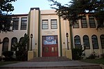
Rancho Cañada de los Nogales
California ranchosHistory of Los AngelesRanchos of Los Angeles County, California
Rancho Cañada de los Nogales was a 1,200-acre (4.9 km2) Mexican land grant in present day Los Angeles County, California given in 1844 by Governor Manuel Micheltorena to José Maria Aguilar. The name means "canyon of the walnut trees" and refers to stands of California Black Walnut trees. The grant extended along the east bank of the Los Angeles River opposite Rancho Los Feliz, and encompassed present day Cypress Park, Mt. Washington and Highland Park. The grant adjoined Rancho San Rafael to the north.
Excerpt from the Wikipedia article Rancho Cañada de los Nogales (License: CC BY-SA 3.0, Authors).Rancho Cañada de los Nogales
Parrish Avenue, Los Angeles
Geographical coordinates (GPS) Address Nearby Places Show on map
Geographical coordinates (GPS)
| Latitude | Longitude |
|---|---|
| N 34.11 ° | E -118.23 ° |
Address
Parrish Avenue 3601
90065 Los Angeles
California, United States
Open on Google Maps


