Hochgern
Bavaria geography stubsChiemgau AlpsMountains of BavariaMountains of the AlpsOne-thousanders of Germany

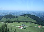
The Hochgern is a mountain found in the Bavarian district of Traunstein, in Germany. It is part of the Chiemgau Alps and has a height of 1748 meters above sea level. The Hochgern marks the junction of the municipalities of Unterwössen, Marquartstein and Ruhpolding, as well as the Urschlau Forest district.
Excerpt from the Wikipedia article Hochgern (License: CC BY-SA 3.0, Authors, Images).Hochgern
Kaibileitensteig, Staudach-Egerndach
Geographical coordinates (GPS) Address Nearby Places Show on map
Geographical coordinates (GPS)
| Latitude | Longitude |
|---|---|
| N 47.75 ° | E 12.516666666667 ° |
Address
Gipfelkapelle
Kaibileitensteig
83224 Staudach-Egerndach
Bavaria, Germany
Open on Google Maps


