Fürberg (Bavarian Forest)
Mountains of BavariaMountains of the Bavarian ForestMountains under 1000 metresRegen (district)

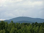
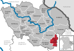
The 880-metre-high Fürberg is one of the smaller mountains in the Danube Hills, the lower part of the Bavarian Forest. It rises in the municipality of Kirchberg im Wald. At the summit is the Plattenstein, an interesting rock formation with a summit cross and view southwards to the higher Brotjacklriegel. A little further below is the Fürberg Chapel, which can be reached by walking along a way of the cross from Untermitterdorf. The Fürberg can be climbed on various footpaths in a short time from the small villages of Raindorf, Untermitterdorf or Berneck.
Excerpt from the Wikipedia article Fürberg (Bavarian Forest) (License: CC BY-SA 3.0, Authors, Images).Fürberg (Bavarian Forest)
Fürbergstraße,
Geographical coordinates (GPS) Address Nearby Places Show on map
Geographical coordinates (GPS)
| Latitude | Longitude |
|---|---|
| N 48.8706 ° | E 13.2125 ° |
Address
Gipfelkreuz
Fürbergstraße
94259
Bavaria, Germany
Open on Google Maps


