place

Büchelstein

Deggendorf (district)Mountains of BavariaMountains of the Bavarian ForestMountains under 1000 metres

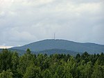
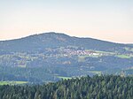
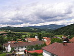
The Büchelstein is a mountain, 832 m above sea level (NN) high, in the southern Bavarian Forest near the higher peak of the Brotjacklriegel. Its forested slopes rise above the bowl of the Lallinger Winkel in the east and the village of Grattersdorf to the north. Just below the highest point is a lookout rock with a large summit cross and wide panoramas over parts of Lower Bavaria. In föhn conditions in autumn even the northern chain of the Alps may be seen from the Dachstein to the Zugspitze. In addition there is a starting point here for hang gliders, that take off in suitable right thermal conditions. Several very short paths lead to the Büchelstein from Grattersdorf, Kerschbaum or Langfurth and the E8 European long distance path passes close to the lookout rocks. The Büchelstein may have given its name to the local dish known as Pichelsteiner Eintopf. On 17 June 1839, on the initiative of the Grafenau Landrichter, Jakob Strelin, the first Büchelstein Festival (Büchelsteiner Fest) was celebrated. It later moved to Grattersdorf.

Excerpt from the Wikipedia article Büchelstein (License: CC BY-SA 3.0, Authors).

Büchelstein
DEG 9, Lalling (VGem)

Geographical coordinates (GPS) Address External links Nearby Places
placeShow on map

Wikipedia: BüchelsteinContinue reading on Wikipedia

Geographical coordinates (GPS)

Latitude Longitude
N 48.808055555556 ° E 13.175833333333 °
placeShow on map

Address

Büchelstein

DEG 9
94541 Lalling (VGem)
Bavaria, Germany
mapOpen on Google Maps

linkWikiData (Q1020315)
linkOpenStreetMap (459569909)

Share experience

Nearby Places

Lallinger Winkel
Lallinger Winkel

The Lallinger Winkel is a high valley, 162 km² in area, named after the village of Lalling, in the county of Deggendorf in the Bavarian Forest, Germany. The region opens into the Danube plain to the southeast but is delimited to the northwest, north and east by the mountain ridges of the Danube Hills which keep at bay the cold winds and rain. Apart from Lalling, the Lallinger Winkel also extends into the municipalities of Schaufling and Hunding. In the south near Auerbach the Lallinger Winkel is adjoined by the Hengersberg-Schwanenkirchen Tertiary Bay. From a geological view, the region is a section of the southern Bohemian Massif. Its rocks include various gneisses and granites. The region around Lalling was developed as early as the foundation phase of Niederaltaich Abbey in the 8th century. During the 150-year initial period of clearances, many villages were built in the Lallinger Winkel. The abbey used the favourable climatic conditions for orchards and encouraged the settlers to grow apples, pears and peaches. From 1861 to 1904 Lalling was the centre of a district fruit nursery. Even today the Lallinger Winkel is characterised by orchards and is called the 'fruit basket of the Bavarian Forest' (Obstschüssel des Bayerischen Waldes). Many small villages grow the traditional scattered orchards (Streuobstwiesen). The initiative Scattered Orchards Beyond the Year 2000 (Streuobstanbau über das Jahr 2000) led to new plantings of thousands of standard fruit trees and the establishment of the freely accessible scattered orchard experience garden in Panholling, Hunding. Especially when the trees are in bloom or at harvest time, the orchards in the Lallinger Winkel are important for tourism. Also well known are the Lallingen snowdrop meadows (Lallinger Schneeglöckerlwiese) and spring snowflakes.