Salisbury Plain

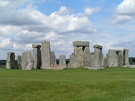
Salisbury Plain is a chalk plateau in southern England covering 300 square miles (780 km2). It is part of a system of chalk downlands throughout eastern and southern England formed by the rocks of the Chalk Group and largely lies within the county of Wiltshire, but stretches into Hampshire. The plain is famous for its rich archaeology, including Stonehenge, one of England's best known landmarks. Large areas are given over to military training; thus, the sparsely populated plain is the biggest remaining area of calcareous grassland in northwest Europe. Additionally, the plain has arable land, and a few small areas of beech trees and coniferous woodland. Its highest point is Easton Hill.
Excerpt from the Wikipedia article Salisbury Plain (License: CC BY-SA 3.0, Authors, Images).Salisbury Plain
Hungerford Lane,
Geographical coordinates (GPS) Address Nearby Places Show on map
Geographical coordinates (GPS)
| Latitude | Longitude |
|---|---|
| N 51.155 ° | E -1.809 ° |
Address
Hungerford Lane
SP4 7BT , Wilsford cum Lake
England, United Kingdom
Open on Google Maps


