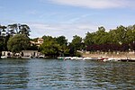
Draveil
Communes of EssonnePages including recorded pronunciationsPages with French IPAPages with disabled graphs

Draveil (French pronunciation: [dʁavɛj] ) is a commune in the Essonne department in the southern outer suburbs of Paris, France. It is located 19.1 km (11.9 mi) from the centre of Paris at Notre-Dame. In 2021, it had a population of 29,173. It was formally twinned with Hove, East Sussex in the United Kingdom.With a score of 7.16/10, Draveil ranks 49th among the 100 best French towns with a population of over 20,000 inhabitants. This result is a survey conducted permanently among the French population and takes into account the following factors : environment, security, medical facilities, cultural events, sports, shops and transport.
Excerpt from the Wikipedia article Draveil (License: CC BY-SA 3.0, Authors, Images).Draveil
Avenue de Villiers, Évry
Geographical coordinates (GPS) Address Website Nearby Places Show on map
Geographical coordinates (GPS)
| Latitude | Longitude |
|---|---|
| N 48.6852 ° | E 2.408 ° |
Address
Mairie de Draveil
Avenue de Villiers 3
91211 Évry
Ile-de-France, France
Open on Google Maps


