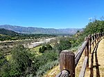
Rancho Santa Ana
1837 establishments in Alta CaliforniaCalifornia ranchosRanchos of Ventura County, California

Rancho Santa Ana was a 21,522-acre (87.10 km2) Mexican land grant in present day Ventura County, California given in 1837 by Governor Juan Alvarado to Crisogono Ayala and Cosme Vanegas. Rancho Santa Ana was located inland in the Ventura River Valley on the west side of the Ventura River across from Rancho Ojai which was granted in the same year. Rancho Santa Ana encompassed present day Lake Casitas and Oak View.
Excerpt from the Wikipedia article Rancho Santa Ana (License: CC BY-SA 3.0, Authors, Images).Rancho Santa Ana
Geographical coordinates (GPS) Address Nearby Places Show on map
Geographical coordinates (GPS)
| Latitude | Longitude |
|---|---|
| N 34.4 ° | E -119.33 ° |
Address
93022
California, United States
Open on Google Maps


