South Bank, Redcar and Cleveland

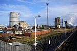
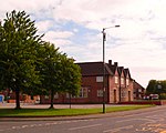
South Bank is a former industrial town in the Redcar and Cleveland borough in North Yorkshire, England on the south bank of the River Tees. It is 3 miles (4.8 km) east of Middlesbrough and 6 miles (9.7 km) south-west of Redcar. The town is served by South Bank railway station.Within Redcar and Cleveland, the South Bank ward had a population of 6,548 at the 2011 census. It forms part of the Teesside built-up area's Middlesbrough subdivision. The area is part of Greater Eston.Ormesby's ancient parish was split into civil parishes. South Bank was in Normanby civil parish. In 1894, the area gained a higher population, and South Bank in Normanby Urban District Council was created. A town hall was built for the district in 1878 and was demolished before the urban district merged with Eston Urban District in 1915. The Eston Urban District was abolished in 1968 with the district becoming part of the County Borough of Teesside. In 1974, the county borough, with the area remaining unparished.
Excerpt from the Wikipedia article South Bank, Redcar and Cleveland (License: CC BY-SA 3.0, Authors, Images).South Bank, Redcar and Cleveland
Jones Road,
Geographical coordinates (GPS) Address Nearby Places Show on map
Geographical coordinates (GPS)
| Latitude | Longitude |
|---|---|
| N 54.58 ° | E -1.17 ° |
Address
Jones Road
Jones Road
TS6 6QQ , South Bank
England, United Kingdom
Open on Google Maps


