Attert (river)
AttertBelgian Luxembourg geography stubsBelgium river stubsEurope river stubsInternational rivers of Europe ... and 9 more
Luxembourg geography stubsPages with French IPAPages with German IPARivers of BelgiumRivers of LuxembourgRivers of Luxembourg (Belgium)Rivers of the Ardennes (Belgium)Rivers of the Ardennes (Luxembourg)Tributaries of the Alzette

The Attert (French pronunciation: [atɛʁt], German pronunciation: [ˈatɐt]; Luxembourgish: Atert) is a river flowing through Belgium and Luxembourg, left tributary of the Alzette. Its length is 38 kilometres (24 mi), of which 32 kilometres (20 mi) are in Luxembourg and 6 kilometres (4 mi) in Belgium. Its source is in Nobressart, north-west of Arlon, in the Belgian province Luxembourg. It flows into the river Alzette at Colmar-Berg. It flows through the village of Attert in Belgium, and the towns of Redange, Useldange, Boevange-sur-Attert, and Bissen in Luxembourg.
Excerpt from the Wikipedia article Attert (river) (License: CC BY-SA 3.0, Authors, Images).Attert (river)
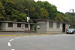
Piste cyclable de l'Attert PC 12,
Geographical coordinates (GPS) Address Nearby Places Show on map
Geographical coordinates (GPS)
| Latitude | Longitude |
|---|---|
| N 49.814933 ° | E 6.09612 ° |
Address
Piste cyclable de l'Attert PC 12
7711
Luxembourg
Open on Google Maps


