place

Montrose, Angus

Montrose, AngusPages with Scottish Gaelic IPAPages with non-numeric formatnum argumentsPopulated coastal places in ScotlandPort cities and towns of the North Sea
Ports and harbours of ScotlandRoyal burghsTowns in Angus, ScotlandUse British English from December 2013
Viewofmontrose
Viewofmontrose

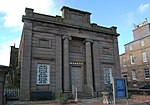
Montrose ( mon-TROHZ; Scottish Gaelic: Mon Rois [mɔn ˈrˠɔʃ]) is a town and former royal burgh in Angus, Scotland. Situated 28 miles (45 kilometres) north of Dundee and 37 miles (60 kilometres) south of Aberdeen, Montrose lies between the mouths of the North and South Esk rivers. It is the northernmost coastal town in Angus and developed as a natural harbour that traded in skins, hides, and cured salmon in medieval times. With a population of approximately 12,000, the town functions as a port, but the major employer is GlaxoSmithKline, which was saved from closure in 2006. The skyline of Montrose is dominated by the 220-foot (67 m) steeple of Old and St Andrew's Church, designed by James Gillespie Graham and built between 1832 and 1834. Montrose is a town with a wealth of architecture, and is a centre for international trade. It is an important commercial port for the oil and gas industry. It is known for its wide thoroughfare and high street, which leads to picturesque closes containing secluded gardens. The town has a view of a tidal lagoon, Montrose Basin, which is considered a nature reserve of international importance. It is the largest inland salt water basin in the UK, and an important habitat for the mute swan. Just outside Montrose is the 18th-century House of Dun, designed by the Scottish architect William Adam and built in 1730 for David Erskine, Lord Dun, 13th Laird of Dun.

Excerpt from the Wikipedia article Montrose, Angus (License: CC BY-SA 3.0, Authors, Images).

Montrose, Angus
Hill Street,

Geographical coordinates (GPS) Address Nearby Places
placeShow on map

Wikipedia: Montrose, AngusContinue reading on Wikipedia

Geographical coordinates (GPS)

Latitude Longitude
N 56.708 ° E -2.467 °
placeShow on map

Address

Hill Street

Hill Street
DD10 8AZ
Scotland, United Kingdom
mapOpen on Google Maps

Viewofmontrose
Viewofmontrose
Share experience

Nearby Places

Links Park
Links Park

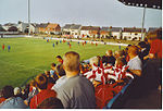
Links Park is a football stadium in Montrose, Scotland. It has been the home ground of Montrose F.C. since 1887. Links Park was opened in 1887 on land rented from the 'Auld Kirk'. To help finance the new ground, Montrose F.C. rented the pitch out for circuses and livestock grazing. The club was eventually able to raise £150 in 1920 to buy a stand, that had been previously used by the Highland Games. A roof was built over the Wellington Street end of the ground in the 1960s. Floodlights were installed in 1971 and first used in a match against Stranraer. The record attendance at the ground was 8,983, for a Scottish Cup quarter-final tie against Dundee in March 1973.Links Park was significantly improved in the 1990s, after the club was taken over by Bryan Keith. The wooden Main Stand was replaced by a cantilevered stand, seating 1,258 people. Other improvements brought the total investment to nearly £1 million, of which the Football Trust provided £400,000. Keith bought the ground in 1995 for £500,000 and granted the club a 25-year lease, without rent. GlaxoSmithKline provided a £250,000 grant in 2006 for the club to install an all-weather surface at Links Park. This pitch was replaced by another artificial surface during the 2015 close season.The current stadium capacity is 4,936. The all-seated Main Stand (South) has a capacity of 1,338 with the West Stand terrace holding a maximum of 1,582 spectators. There is also uncovered standing areas on the North and East sides off the ground. The pitch at the stadium measures 113 x 70 yards. For the 2018–19 season onwards, local junior football club Montrose Roselea have shared the ground.