Foxfield, Cumbria
Cumbria geography stubsFurnessPopulated coastal places in CumbriaSouth Lakeland DistrictUse British English from September 2019 ... and 1 more
Villages in Cumbria

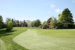
Foxfield is a village on the west coast of Cumbria, England, in the Furness district that was part of Lancashire from 1182 to 1974. It lies on the Duddon Estuary, just outside the Lake District National Park, around ten miles to the north-east of Barrow-in-Furness and one mile out of Broughton-in-Furness. It is part of the parish of Broughton West. The village contains a public house, the Prince of Wales, and Foxfield railway station on the Cumbria Coast Line, where a branch line to Broughton and Coniston used to commence.
Excerpt from the Wikipedia article Foxfield, Cumbria (License: CC BY-SA 3.0, Authors, Images).Foxfield, Cumbria
A595,
Geographical coordinates (GPS) Address Nearby Places Show on map
Geographical coordinates (GPS)
| Latitude | Longitude |
|---|---|
| N 54.258 ° | E -3.215 ° |
Address
A595
LA20 6AL , Broughton West
England, United Kingdom
Open on Google Maps


