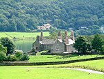
Torver
Civil parishes in CumbriaCumbria geography stubsFurnessSouth Lakeland DistrictVillages in Cumbria

Torver is a village and civil parish in the Westmorland and Furness Unitary Authority of Cumbria, England, 3 miles (4.8 km) south west of the village of Coniston and 1 mile (1.6 km) west of Coniston Water. Farming has always played an important part in Torver's history, though slate mining increased when the Coniston branch of the Furness Railway was opened in the 19th century (it subsequently closed in 1958). Nowadays, the hamlet remains a starting point for many walks around the Duddon Valley and Coniston Water, an area popularised by William Wordsworth.
Excerpt from the Wikipedia article Torver (License: CC BY-SA 3.0, Authors, Images).Torver
Sattery Lane,
Geographical coordinates (GPS) Address Nearby Places Show on map
Geographical coordinates (GPS)
| Latitude | Longitude |
|---|---|
| N 54.337 ° | E -3.102 ° |
Address
Sattery Lane
Sattery Lane
LA21 8BQ , Torver
England, United Kingdom
Open on Google Maps


