Ahr Hills
AhrCentral UplandsLandscapes of Rhineland-PalatinateMountain ranges of North Rhine-WestphaliaMountain ranges of Rhineland-Palatinate ... and 4 more
Pages with German IPARegions of North Rhine-WestphaliaRegions of Rhineland-PalatinateRegions of the Eifel

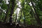
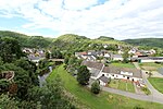
The Ahr Hills (German: Ahrgebirge [ˈaːɐ̯ɡəˌbɪʁɡə] or Ahreifel [ˈaːɐ̯ˌʔaɪfl̩]) are a range of low mountains and hills up to 623.8 m above sea level (NHN) and 25 kilometres (16 mi) long in the Eifel region of Germany, which lie roughly southwest of Bonn on the border between the German states of North Rhine-Westphalia and Rhineland-Palatinate. The forested Ahr Hills have numerous tourist destinations (e. g. Aremberg Castle and the Effelsberg Radio Telescope) and the section of a Roman road with its ancient Eifel Aqueduct.
Excerpt from the Wikipedia article Ahr Hills (License: CC BY-SA 3.0, Authors, Images).Ahr Hills
Bühlenstraße,
Geographical coordinates (GPS) Address Nearby Places Show on map
Geographical coordinates (GPS)
| Latitude | Longitude |
|---|---|
| N 50.5 ° | E 6.8666666666667 ° |
Address
Bühlenstraße
Bühlenstraße
53902
North Rhine-Westphalia, Germany
Open on Google Maps


