place

Tetbury Road railway station

Disused railway stations in GloucestershireFormer Great Western Railway stationsRailway stations in Great Britain closed in 1882Railway stations in Great Britain opened in 1845Use British English from November 2017
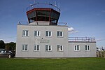
Tetbury Road railway station (site), Gloucestershire (geograph 5876450)

Tetbury Road railway station was built by the Cheltenham & Great Western Union Railway to serve the Gloucestershire villages of Kemble and Coates, and the town of Tetbury.

Excerpt from the Wikipedia article Tetbury Road railway station (License: CC BY-SA 3.0, Authors, Images).

Tetbury Road railway station
A433, Cotswold District Rodmarton

Geographical coordinates (GPS) Address Phone number Website Nearby Places
placeShow on map

Wikipedia: Tetbury Road railway stationContinue reading on Wikipedia

Geographical coordinates (GPS)

Latitude Longitude
N 51.688 ° E -2.0284 °
placeShow on map

Address

A433
GL7 6NZ Cotswold District, Rodmarton
England, United Kingdom
mapOpen on Google Maps

Phone number
The Thames Head Inn

call+441285770259

Website
thamesheadinn.co.uk

linkVisit website

Tetbury Road railway station (site), Gloucestershire (geograph 5876450)
Share experience

Nearby Places

Thames Head
Thames Head

Thames Head is a group of seasonal springs that arise near the village of Coates in the Cotswolds, about three miles south-west of the town of Cirencester, in the county of Gloucestershire, England. The spring water comes from the limestone aquifers of the Cotswolds. One or more of these springs are traditionally identified as the source of the River Thames.In actuality, the source of the River Thames does not have a fixed location – rather, it changes according to the level of the groundwater in the limestone. In dry periods, the groundwater level falls, causing the Thames Head springs to dry up and the river to begin lower down in its course. In wet conditions, the groundwaters rise and the river can begin at one of the Thames Head springs. During the 2022 United Kingdom heat wave, the source dried up completely, shifting 5 miles (8.0 km) downstream to Somerford Keynes.The highest springs of Thames Head are located north of the A433 road (Fosse Way section), in a meadow called Trewsbury Mead. The springs continue immediately south of the A433. The Ordnance Survey identifies Thames Head as the source of the Thames on its maps and the UK's Environment Agency follows their precedent. However, there is also a long-standing alternative view that the real source of the Thames is on a different headstream entirely: at Seven Springs, Gloucestershire, the source of the River Churn, which is officially a tributary of the Thames that joins the Thames at Cricklade and which is longer than the course of the Thames from Thames Head to Cricklade. Further still, a small branch of the Churn runs to the National Star College in Ullenwood, making it the furthest source of the Thames.