place

A419 road

Infobox road instances in the United KingdomInfobox road maps tracking categoryRoads in EnglandTransport in GloucestershireTransport in Wiltshire
Use British English from February 2013
A419 A417 slip road to Cirencester geograph.org.uk 293591

The A419 road is a primary route between Chiseldon near Swindon at junction 15 of the M4 with the A346 road, and Whitminster in Gloucestershire, England near the M5 motorway. The A419 is managed and maintained by a private company, Road Management Group, on behalf of the UK Department for Transport.

Excerpt from the Wikipedia article A419 road (License: CC BY-SA 3.0, Authors, Images).

A419 road
Stroud Road, Cotswold District

Geographical coordinates (GPS) Address Nearby Places
placeShow on map

Wikipedia: A419 roadContinue reading on Wikipedia

Geographical coordinates (GPS)

Latitude Longitude
N 51.71395 ° E -2.00475 °
placeShow on map

Address

Stroud Road

Stroud Road
GL7 6JT Cotswold District
England, United Kingdom
mapOpen on Google Maps

A419 A417 slip road to Cirencester geograph.org.uk 293591
Share experience

Nearby Places

Thames Head
Thames Head

Thames Head is a group of seasonal springs that arise near the village of Coates in the Cotswolds, about three miles south-west of the town of Cirencester, in the county of Gloucestershire, England. The spring water comes from the limestone aquifers of the Cotswolds. One or more of these springs are traditionally identified as the source of the River Thames.In actuality, the source of the River Thames does not have a fixed location – rather, it changes according to the level of the groundwater in the limestone. In dry periods, the groundwater level falls, causing the Thames Head springs to dry up and the river to begin lower down in its course. In wet conditions, the groundwaters rise and the river can begin at one of the Thames Head springs. During the 2022 United Kingdom heat wave, the source dried up completely, shifting 5 miles (8.0 km) downstream to Somerford Keynes.The highest springs of Thames Head are located north of the A433 road (Fosse Way section), in a meadow called Trewsbury Mead. The springs continue immediately south of the A433. The Ordnance Survey identifies Thames Head as the source of the Thames on its maps and the UK's Environment Agency follows their precedent. However, there is also a long-standing alternative view that the real source of the Thames is on a different headstream entirely: at Seven Springs, Gloucestershire, the source of the River Churn, which is officially a tributary of the Thames that joins the Thames at Cricklade and which is longer than the course of the Thames from Thames Head to Cricklade. Further still, a small branch of the Churn runs to the National Star College in Ullenwood, making it the furthest source of the Thames.

Cirencester Amphitheatre

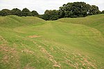
Cirencester Amphitheatre was a Roman amphitheatre in Cirencester, Gloucestershire, England. Its remains are scheduled as an ancient monument.Archaeological digs have uncovered the earthworks, revealing the outline of the construction, which is still visible, with the banking reaching 25 feet from the bottom of the arena. The arena itself is approximately 150 feet (46 m) by 135 feet (41 m). Roman artefacts including coins and pottery have been discovered on the site. It is estimated that it was constructed towards the beginning of the 2nd century. In Roman Britain, Cirencester was known as Corinium Dobunnorum, and was the second biggest town in Britannia, after Londinium (London). This amphitheatre is also the second largest, which indicates the significance of the location in Roman times. Although only slightly larger in diameter than the amphitheatre in Silchester, it has much higher sides. The earthworks show evidence of tiered wooden seats for around 8000 people, placed upon terraces made of stone, although a timber-only structure may have existed before the 2nd century. There are two entrances, at the north-east and south-west ends of the stadium.During the 5th century, when the Western Roman Empire was under attack and soldiers returned to Rome to defend it, the amphitheatre was fortified to defend against the invading Saxons. Wooden structures were erected within the arena, placed in postholes, and the north-east entrance was partly blocked.Unlike other amphitheatres, it is aligned in parallel to the streets of the town.It has also been referred to as the 'Bull Ring', because the sport of bull-baiting used to take place there.In 2012, plans were announced by the Cirencester Town Council to improve access and signage at the site. Further plans for a visitor centre and car park followed in 2014.