place

Crabstane of Aberdeen

Buildings and structures in AberdeenHistory of AberdeenMonuments and memorials in AberdeenUse British English from January 2018
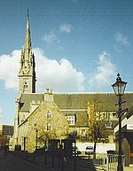
CrabStone Geograph 742989 by Colin Smith

The Crabstane (alt. Crabs Stone, Craibstone, Craib Stone, Craibstane or Crabe Stone) is a boundary stone that used to mark out part of Craibstone Croft which was located near Hardgate, Aberdeen.The stone has a plaque above it with the inscription as follows: The Crabstane. Boundary stone on lands belonging to John Crab, Baillie of the Burgh in 1314. The stone also marks the site of the skirmish in 1571 between the rival families of Gordon and Forbes and of an engagement in 1644 between the citizens of Aberdeen and the Royalist forces of the Marquis of Montrose. The skirmish refers to the Battle of Craibstone on 20 November 1571.

Excerpt from the Wikipedia article Crabstane of Aberdeen (License: CC BY-SA 3.0, Authors, Images).

Crabstane of Aberdeen
Langstane Place, Aberdeen City City Centre

Geographical coordinates (GPS) Address Website Nearby Places
placeShow on map

Wikipedia: Crabstane of AberdeenContinue reading on Wikipedia

Geographical coordinates (GPS)

Latitude Longitude
N 57.142919 ° E -2.108102 °
placeShow on map

Address

Spiritualist

Langstane Place 67
AB11 6EN Aberdeen City, City Centre
Scotland, United Kingdom
mapOpen on Google Maps

Website
thespiritualistaberdeen.co.uk

linkVisit website

CrabStone Geograph 742989 by Colin Smith
Share experience

Nearby Places

Lang Stane, Aberdeen

The Lang Stane in Aberdeen, Scotland is a granite Menhir type standing stone that sits recessed into an alcove at the south east corner of 10 Langstane Place, just off Aberdeen's main thoroughfare Union Street. There is suggestion that the nearby Crabstane and the Lang Stane were both used as boundary stones of Craibstone Croft, site of the Battle of Craibstone in 1571. Whilst close to its location as a boundary marker its current site is unlikely to be the exact location of the Craibstone boundary as it would have been moved during the construction of Union Street and the surrounding infrastructure. Prior to this the stone was probably part of a stone circle, the conclusion taken as the base has been carved into a keel shape- common of recumbent stone circles found in Aberdeenshire, which usually date to approximately 3000BC. The stone has dimensions of 1.8m height, 0.68m breadth and approximately 0.3m thickness.On Paterson's Map of the Burgh of Aberdeen printed in 1746 prior to the construction of Langstane Place, the stone can be seen in approximately its current location, though it does not appear as part of a stone circle. Throughout the city the name reoccurs with the single word differentiation 'Langstane' - indeed the area of the city where the Lang Stane sits is within the aptly named former Langstane political ward. The title occurs often in local business and areas with examples such as the former Langstane Kirk (now Soul), Langstane Press and Langstane Housing Association. Curiously in the immediate area of Aberdeen there are other standing stones with same name, such as the Lang Stane of Hilton area of the city and the Lang Stane of Auquhollie just south Aberdeen.