place

St. Anthony of Padua Catholic Church

19th-century Roman Catholic church buildings in the United StatesChurches in Jersey City, New JerseyChurches on the National Register of Historic Places in New JerseyGothic Revival church buildings in New JerseyNational Register of Historic Places in Hudson County, New Jersey
New Jersey Register of Historic PlacesNew Jersey Registered Historic Place stubsNew Jersey church stubsPolish-American Roman Catholic parishes in the United StatesPolish-American culture in New JerseyRoman Catholic churches completed in 1892Roman Catholic churches in New JerseyUnited States Roman Catholic church stubs
Anthony Padua RCC JC jeh

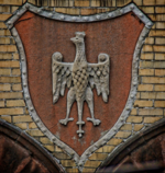
St. Anthony of Padua Catholic Church is a historic Catholic church in The Village section of Jersey City. It is best known for its former school and its boys' basketball program coached by Bob Hurley, Sr.

Excerpt from the Wikipedia article St. Anthony of Padua Catholic Church (License: CC BY-SA 3.0, Authors, Images).

St. Anthony of Padua Catholic Church
Pavonia Avenue, Jersey City

Geographical coordinates (GPS) Address Nearby Places
placeShow on map

Wikipedia: St. Anthony of Padua Catholic ChurchContinue reading on Wikipedia

Geographical coordinates (GPS)

Latitude Longitude
N 40.728055555556 ° E -74.049166666667 °
placeShow on map

Address

Pavonia Avenue 338
07302 Jersey City
New Jersey, United States
mapOpen on Google Maps

Anthony Padua RCC JC jeh
Share experience

Nearby Places

Dr. Ronald E. McNair Academic High School

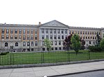
Dr. Ronald E. McNair Academic High School (often dubbed Academic previous to its dedication, or as McNair) is a magnet public high school located at 123 Coles Street in Jersey City, in Hudson County, United States. The school is named in memory of Dr. Ronald E. McNair, the astronaut and scientist who died in the Space Shuttle Challenger disaster. McNair is part of the Jersey City Public Schools district. The school has been accredited by the Middle States Association of Colleges and Schools Commission on Elementary and Secondary Schools since 1979 and is under Probationary Accreditation status as of 2022.As of the 2020–21 school year, the school had an enrollment of 713 students and 51.0 classroom teachers (on an FTE basis), for a student–teacher ratio of 14.0:1. There were 250 students (35.1% of enrollment) eligible for free lunch and 51 (7.2% of students) eligible for reduced-cost lunch.The school offers a wide selection of Advanced Placement (AP) Courses, in addition to a standard curriculum that contains courses at the Honors level. 21 AP courses were offered in 2010, with 897 students taking exams and 83.8% of those taking the exams scoring 3 or higher, more than quadruple the statewide average. Most electives are regular, unweighted classes. From 2008 to 2010, 100% of the class has graduated and in 2010 a full 100% of the student body indicated that they planned to attend a four-year college.

Harsimus Stem Embankment

The Harsimus Stem Embankment, also called Sixth Street Embankment, is a half-mile-long historic railroad embankment, now abandoned and largely overgrown with foliage, in the heart of the historic downtown of Jersey City, New Jersey in the United States. The 27-foot-high (8.2 m) embankment runs along the south side of Sixth Street west from Marin Boulevard to Brunswick Street. It is the border between the Harsimus and Hamilton Park neighborhoods. The overhead tracks of the beam bridge west of Brunswick Street were dismantled but the stone abutments remain.This elevated stone structure once carried seven tracks of the Pennsylvania Railroad's Passaic and Harsimus Line to its freight yards and carfloat operations on the Hudson River at Harsimus Cove, and to its warehouse and distribution facility (now Harborside Financial Center). The line was part of the railroad's holdings on the waterfront, which included the Exchange Place passenger terminal and the Greenville Yard. The Embankment is listed on the New Jersey Register of Historic Places, is eligible for the National Register, and is a Jersey City municipal landmark.In 2010, a local citizens' movement lobbied local governments, chiefly Hudson County and the city of Jersey City, to acquire the land and convert the embankment to a public park. The developer who owns the land where the embankment is located is opposed. In September 2010 a federal court ruled that sale to the developer was legal and that the city has previously not exercised its first option to buy the right-of-way from Conrail. The decision meant the city could claim the structure through eminent domain. A $1 million grant request was not honored. The developer's proposals to sell portions of the land to the city were rejected in 2011. The case was brought to an appeals court, which found that the case against the developer could proceed. In January 2012 it was announced that a deal had been arranged whereby the city would purchase the property for $7 million. In September 2012 it was ruled that Conrail had not gone through the required process of "abandonment" and was not legally able to sell the property. Again in 2020, a deal was announced.The city has agreed to allow for high-rise residential development along one block of the embankment.

Hilltop, Jersey City

The Hilltop is the eastern section of the Journal Square district of Jersey City, New Jersey. The name is a reflection of its location atop Bergen Hill, the southern portion of the Hudson Palisades, on either side of the cut, or excavated ravine, through which the Port Authority Trans Hudson rapid transit system travels, offering some streets views of Downtown Jersey City, the New York Skyline, and the Upper New York Bay. The northern part of Hilltop is located to the east of Five Corners. The neighborhoods borders are created by other excavations, namely Bergen Arches, the Long Dock Tunnel, and The Depressed Highway. Soon after passing the Hudson County Courthouse, Newark Avenue begins its descent. Rising above the avenue at the beginning of Palisade Avenue is the national historic landmark Jersey City High School. Designed by John T. Rowland (who also designed the Jersey City Medical Center and the Labor Bank Building), it was later renamed for William L. Dickinson, the Superintendent of Schools from 1872 until his death on November 3, 1883. Newark Avenue separates the school grounds from Jersey City and Harsimus Cemetery, originally developed in the mid 19th century. Across Palisade is the 1942 Hudson Gardens Housing Project. Behind the complex is Washburn Avenue, named for Richard Charles Washburn, a member of the New Jersey General Assembly. St Joseph's Church, built in 1873, is home to the old Catholic parish in the city.The Island is a small enclave within the Hilltop neighborhood which takes its name from its location atop an isolated outcropping of Bergen Hill formerly called Mount Pleasant which has been diminished in size by the railroads tracks which surround it. Vehicular traffic can travel along Chestnut Avenue onto the island, which is also served by a footbridge at Waldo Avenue. The name Island was used as early as the 1960s and though unknown to many because of the small size.South of the rail lines and east of Bergen Square, Summit Avenue and Baldwin Avenue continue along the ridge of the Palisades, passing by the Jersey City Armory. Mill Road connects the neighborhood with the former West End and is named for John Prior's Mill on Harsimus Creek. Mercer Street, one of the few that keeps its name as it rises from low-lying downtown is named for General Hugh Mercer, who stayed with John Prior at his home several times. The neighborhood overlooks the Waldo Yards, originally used by the Pennsylvania Railroad Jersey City Branch, and now partially used by Port Authority Trans Hudson maintenance facilities. In October 1948, the Freedom Train was stationed at the yards for two days during its trip across the United States.A proposed development between the Journal Square Transportation Center, and neighbourhood called Journal Squared would include the city's tallest residential buildings. In 2012, the city approved a proposal to build a 42-storey residential tower adjacent to the Newkirk House, the oldest surviving structure in the city. There is additional pressure to increase housing density in the neighborhood.