place

Twin Lakes State Beach

Beaches of Santa Cruz County, CaliforniaCalifornia State BeachesMonterey BayParks in Santa Cruz County, CaliforniaSan Francisco Bay Area geography stubs
Santa Cruz, California
Twin Lakes State Beach and lighthouse

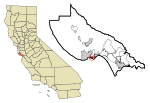
Twin Lakes State Beach is a beach located on Monterey Bay directly south of the Santa Cruz Yacht Harbor Santa Cruz, in coastal Santa Cruz County, northern California. This mile-long shoreline is a popular place for swimming and picnicking, along with birdwatching in the adjacent Schwan's Lake. It has a small craft harbor parallel to East Cliff and Portola Drives.

Excerpt from the Wikipedia article Twin Lakes State Beach (License: CC BY-SA 3.0, Authors, Images).

Twin Lakes State Beach
East Cliff Drive,

Geographical coordinates (GPS) Address Nearby Places
placeShow on map

Wikipedia: Twin Lakes State BeachContinue reading on Wikipedia

Geographical coordinates (GPS)

Latitude Longitude
N 36.962222222222 ° E -121.99972222222 °
placeShow on map

Address

East Cliff Drive
95062
California, United States
mapOpen on Google Maps

Twin Lakes State Beach and lighthouse
Share experience

Nearby Places

Santa Cruz harbor
Santa Cruz harbor

The Santa Cruz Small Craft Harbor (also "Santa Cruz Harbor", but see below) is situated in Santa Cruz, California, on the site of the former Woods Lagoon. Built in 1962–1963, its public use specializes in boating and extracurricular marine activities for the local community and visitors. The harbor straddles the city limits which runs down the center of Arana Gulch; the west side of the harbor is in Santa Cruz's Seabright neighborhood while the east is in unincorporated Santa Cruz County. The harbor is split into two portions: the south or "lower" harbor and the north or "upper" harbor. The lower harbor was completed first and provides slips up to 60', and is itself split into an east and a west side. The west lower harbor contains docks AA, A–F, and FF; sailboat dry storage and hoist launch; a hand launch ramp for small, lightweight craft; and a small Coast Guard facility. It is adjacent to the Santa Cruz Yacht Club. It hosts a mixture of sail and power craft, and is the location for most of the harbor's slips over 40 feet. It is accessed off of Seabright and Atlantic avenues.The east lower harbor has docks L–T, a boatyard, the harbor offices, a launch ramp, the harbor's fuel dock, and a number of harbor-related businesses. Most of the commercial fishing fleet is berthed there, including facilities for off-loading fish. Access is from 5th Avenue and East Cliff Drive; a water taxi connects the east and west lower harbor during the summer months.The upper harbor is separated from the lower by two fixed bridges; one carrying Murray St, the other a railroad line. Due to the limited clearance, powerboats and smaller sailboats comprise most of the boats docked in the upper harbor; many of the sailboats must lower their masts to pass under. Docks G–J and U–X provide slips to 45'. The upper harbor also contains the harbor's maintenance base, two dry storage areas, and the harbor's RV park. Access to the upper harbor is from 7th Avenue.