place

Frankfort High School (Kentucky)

1889 establishments in KentuckyBuildings and structures in Frankfort, KentuckyEducational institutions established in 1889Kentucky school stubsPublic high schools in Kentucky
Schools in Franklin County, Kentucky

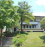
Frankfort High School is located at 328 Shelby Street in Frankfort, Kentucky, United States. It is part of the Frankfort Independent School District which consists of Second Street School, Panther Transition Academy, and Frankfort High School. In December, 1885, the original building burned. Students had classes in various buildings in downtown until the school could be rebuilt. The new building was built large enough to allow for a full high school. Frankfort High School as we think of it today began in 1889. The school had a 3-year program and the 1st graduating of 7 girls was in 1892. In 1892, Frankfort City Schools became the first school in Kentucky to offer kindergarten. A commercial school program was added in 1904. A 4-year program was started in 1909. In 1956, Frankfort High School became desegregated. Notable graduates include George C. Wolfe, Steve Nunn, Major general Edgar E. Hume , Lt. Governor Crit Luallen, diplomat James Sutterlin, and silent film star Bob Custer (Raymond Glenn). The Frankfort High mascot is a panther. The U.S. News & World Report named Frankfort High School the 12th best High School in Kentucky in 2014.

Excerpt from the Wikipedia article Frankfort High School (Kentucky) (License: CC BY-SA 3.0, Authors).

Frankfort High School (Kentucky)
West 4th Street, Frankfort

Geographical coordinates (GPS) Address Nearby Places
placeShow on map

Wikipedia: Frankfort High School (Kentucky)Continue reading on Wikipedia

Geographical coordinates (GPS)

Latitude Longitude
N 38.19279 ° E -84.87689 °
placeShow on map

Address

West 4th Street
40601 Frankfort
Kentucky, United States
mapOpen on Google Maps

Share experience

Nearby Places

Central Frankfort Historic District

The Central Frankfort Historic District in Frankfort, Kentucky was listed on the National Register of Historic Places in 2009.The district includes 401 resources (buildings, structures, objects, sites) on 126 acres (51 ha). It is roughly bounded by East and West 2nd St., Logan St., the Kentucky River, High St., and Mero St.The district was created to merge and expand upon previously listed historic resources. It includes all of: Liberty Hall (Frankfort, Kentucky), NRHP-listed in 1971, and a National Historic Landmark Old Governor's Mansion, NRHP-listed in 1971 Old Statehouse, NRHP-listed in 1971 Old U.S. Court House & Post Office, NRHP-listed in 1974 Corner in Celebrities Historic District, NRHP-listed in 1971 Old Statehouse Historic District (Frankfort, Kentucky), NRHP-listed in 1980 Frankfort Commercial Historic District, NRHP-listed in 1982 with additional documentation in 2008.It also includes portions of Second Street and Shelby Street within the South Frankfort Neighborhood Historic District, NRHP-listed in 1982, which contains the current Kentucky State Capitol, Governor's Mansion, and surrounding residential area. It additionally includes and recognizes properties, in and outside of the previously listed areas, of later periods of significance than previously recognized. The district thus created constitutes a "well-defined evolutionary district which portrays development in Frankfort from the 1790s into the 1960s."When listed, its 401 resources included 241 resources previously listed, plus 78 new contributing buildings, a new contributing site, four new contributing structures, two new contributing objects, and 24 new non-contributing resources, all in a 126 acres (51 ha) area.It includes four properties documented in the Historic American Buildings Survey during 1937-1940: Good Shepherd Roman Catholic Church, Liberty Hall, Old State House, and Orlando Brown House.The district was deemed significant "on a statewide basis as a strong concentration of primarily residential and commercial historic resources built largely on a late-eighteenth-century grid of streets encompassing historic state governmental buildings, representative of the cultural patterns of governance, commerce, and community planning, and containing the homes of a series of individuals of transcendent importance to the locale, state, and nation."