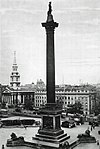
St Martin-in-the-Fields (parish)
1922 disestablishments in EnglandBills of mortality parishesFormer civil parishes in LondonHistory of local government in London (pre-1855)History of the City of Westminster ... and 1 more
Parishes governed by vestries (Metropolis)

St Martin-in-the-Fields was a civil parish in the metropolitan area of London, England. It took its name from the church of St Martin-in-the-Fields and was within the Liberty of Westminster. It included within its boundaries the former extra-parochial areas of Buckingham Palace and St James's Palace.
Excerpt from the Wikipedia article St Martin-in-the-Fields (parish) (License: CC BY-SA 3.0, Authors, Images).St Martin-in-the-Fields (parish)
Trafalgar Square, City of Westminster Covent Garden
Geographical coordinates (GPS) Address Website Nearby Places Show on map
Geographical coordinates (GPS)
| Latitude | Longitude |
|---|---|
| N 51.508888888889 ° | E -0.12694444444444 ° |
Address
St Martin-in-the-Fields
Trafalgar Square
WC2N 4JH City of Westminster, Covent Garden
England, United Kingdom
Open on Google Maps


