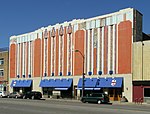
Midtown Detroit
Culture of DetroitMidtown DetroitNeighborhoods in DetroitUse mdy dates from September 2021Wikipedia spam cleanup from December 2013 ... and 1 more
Woodward Avenue

Midtown Detroit is a commercial and residential district located along the east and west side of Woodward Avenue, north of Downtown Detroit, and south of the New Center area. The area includes several historic districts. In addition, it contains a residential area of some 14,550 people and covers 2.09 sq mi. The community area of neighborhoods is bounded by the Chrysler Freeway (I-75) on the east, the Lodge Freeway (M-10) on the west, the Edsel Ford Freeway (I-94) on the north, and the Fisher Freeway (I-75) on the south.
Excerpt from the Wikipedia article Midtown Detroit (License: CC BY-SA 3.0, Authors, Images).Midtown Detroit
East Alexandrine Street, Detroit Midtown
Geographical coordinates (GPS) Address Nearby Places Show on map
Geographical coordinates (GPS)
| Latitude | Longitude |
|---|---|
| N 42.350555555556 ° | E -83.059444444444 ° |
Address
Bicenntennial Tower
East Alexandrine Street 4
48201 Detroit, Midtown
Michigan, United States
Open on Google Maps


