place

Sacred Falls State Park

1999 in HawaiiIUCN Category IIProtected areas of OahuState parks of HawaiiUse mdy dates from July 2022
Sacred falls 2
Sacred falls 2

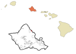
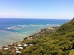
Sacred Falls State Park (traditionally named Kaliuwaʻa in Hawaiian) is a closed state park located in Hauʻula on the North Shore of the Hawaiian island of Oʻahu. It has been closed since the rockfall that occurred on Mother's Day in 1999. Although people caught entering the park are subject to hefty fines, hikers continue to trespass into the park. The park encompasses Kaluanui gulch and the waterfalls at its end. It is a wahi pana in the district (moku) of Koʻolauloa, with much associated Hawaiian lore: "Kaliuwaa (sic) is the most famous of all the valleys in the district of Koolauloa."According to Hawaiian beliefs, visitors were encouraged to lay leaves and place stones on them, as they entered the valley, gorge, and falls to show respect to the demigod associated with the location.

Excerpt from the Wikipedia article Sacred Falls State Park (License: CC BY-SA 3.0, Authors, Images).

Sacred Falls State Park

Geographical coordinates (GPS) Address Nearby Places
placeShow on map

Wikipedia: Sacred Falls State ParkContinue reading on Wikipedia

Geographical coordinates (GPS)

Latitude Longitude
N 21.573333333333 ° E -157.91416666667 °
placeShow on map

Address

Honolulu County


Hawaii, United States
mapOpen on Google Maps

Sacred falls 2
Sacred falls 2
Share experience

Nearby Places

Huilua Fishpond
Huilua Fishpond

Huilua Fishpond, in Ahupuaʻa O Kahana State Park on windward Oʻahu, is one of the few surviving ancient Hawaiian fishponds that were still operational well into the 20th century. It was declared a U.S. National Historic Landmark in 1962, shortly after it had been severely damaged by the 1960 tsunami. It was added to the National Register of Historic Places on December 29, 1962.The fishpond may have started as a sandbar where ocean currents met the stream mouth. A 500-foot (152 m) permeable rock seawall (called kuapā in Hawaiian) was added along the shoreline to enclose about 7 acres (2.8 ha) of fertile brackish water. The wall was about 4 feet (1.2 m) wide and stood about 4 feet (1.2 m) above high tide, with two lashed-pole sluice gates (called mākāhā) that allowed little fish in but kept bigger fish from escaping. The name Huilua, which can be translated 'join-twice', may refer to the two gates. The favorite type of fish in the pond were ʻamaʻama (flathead grey mullet), which reproduce in the ocean but can live in either fresh, brackish, or salt water.Many Hawaiian fishponds were built between about the early 1400s and early 1600s. They were especially numerous in large expanses of shallow sea, such as Kāneʻohe Bay and Pearl Harbor. Each fishpond had a pondkeeper (kiaʻi loko) who lived nearby and oversaw its maintenance. Sam Pua Haʻaheo was the pondkeeper for Huilua from 1924, just after the 1923 tsunami, until 1946, when another tsunami hit. The fishpond suffered further tsunami damage in 1957 and 1960. The most recent restoration work began in 1993 as a cooperative project between the State Park service and Friends of Kahana, an organization of local residents.

Molii Fishpond
Molii Fishpond

Moliʻi Fishpond is located southeast of Kamehameha Highway between Kualoa and Johnson Roads, near Kaneohe, on the island of Oahu, in the U.S. state of Hawaii. The pond encompasses 125 acres (50.59 ha; 0.20 sq mi) The locale is part of the ahupuaa (land division) of Hakipuu. The Molii pond is part of Kualoa Ranch. Tilapia, mullet and moi are found within the pond. Commercial fishing operations are contracted out.Ancient Hawaiian fishponds were noted in the 1826 journal of William Ellis, the naturalist on James Cook's third voyage (1776–1779): They [the Hawaiians] have numerous small lakes and ponds, frequently artificial, wherein they breed fish of various kinds, and in tolerable abundance. Moli'i, along with Huilua, Kahaluu and Heʻeia are the only four original Hawaiian fishponds remaining on Oahu. Fishponds were used by the ancient Hawaiians for ocean husbandry. Each pond had a set of sluices that controlled the seawater flow and the fish available in the pond for harvesting. Moli'i had five such sluices, and three of the sluices were still in place in 1972 when the pond was listed on the National Register of Historic Places listings in Oahu. This system of harvesting ocean catch was unique to Hawaii, and does not exist within other areas of ancient Polynesia. The 4,000-foot (1,200 m) wall which partitions the pond from Kaneohe Bay dates back to the earliest Hawaiian settlement of the land, and is traditionally attributed to the Menehune of Hawaiian mythology. The craftsmanship applied in constructing the wall is similar to brickwork, in that the gaps and crevices between the stacked stones are plugged with coral and smaller rocks.