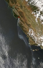
Loma Prieta

Loma Prieta (from Spanish loma -hill, prieta -dark) is 3,790 feet (1,160 m) high and is the highest peak in the Santa Cruz Mountains in Northern California.Although the 1989 Loma Prieta earthquake was named for this mountain, the actual epicenter was five miles southwest of the peak, across the San Andreas fault, in The Forest of Nisene Marks State Park. In the 19th century, the peak was called Mount Bache, a name given in honor of Alexander Dallas Bache; the name is no longer in use.From 1955 to 2005, the mountain was the longtime site for the transmitter tower of San Jose television station KNTV. In September 2005, it moved its transmitter 83 kilometres (52 mi) northwest to San Bruno Mountain after it became the Bay Area's NBC affiliate.
Excerpt from the Wikipedia article Loma Prieta (License: CC BY-SA 3.0, Authors, Images).Loma Prieta
Loma Prieta Road,
Geographical coordinates (GPS) Address Nearby Places Show on map
Geographical coordinates (GPS)
| Latitude | Longitude |
|---|---|
| N 37.111011844 ° | E -121.844161333 ° |
Address
Loma Prieta Road
California, United States
Open on Google Maps


