Santa Cruz Mountains
California Coast RangesMountain ranges of Monterey County, CaliforniaMountain ranges of San Benito County, CaliforniaMountain ranges of San FranciscoMountain ranges of San Mateo County, California ... and 5 more
Mountain ranges of Santa Clara County, CaliforniaMountain ranges of Santa Cruz County, CaliforniaSanta Cruz MountainsSubregions of the San Francisco Bay AreaVague or ambiguous time from July 2022

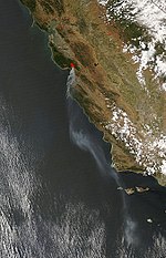
The Santa Cruz Mountains (Mutsun Ohlone: Mak-sah-re-jah, "Sharp Ridged Mountain of the Eagle" or "People of the Eagle Mountain") are a mountain range in central and Northern California, United States, constituting a part of the Pacific Coast Ranges. They form a ridge down the San Francisco Peninsula, south of San Francisco. They separate the Pacific Ocean from the San Francisco Bay and the Santa Clara Valley, and continue south to the Central Coast, bordering Monterey Bay and ending at the Salinas Valley. The range passes through the counties of San Mateo, Santa Clara, and Santa Cruz, with the Pajaro River forming the southern boundary.
Excerpt from the Wikipedia article Santa Cruz Mountains (License: CC BY-SA 3.0, Authors, Images).Santa Cruz Mountains
Mount Umunhum Loma Prieta Road,
Geographical coordinates (GPS) Address Nearby Places Show on map
Geographical coordinates (GPS)
| Latitude | Longitude |
|---|---|
| N 37.116666666667 ° | E -121.85 ° |
Address
Mount Umunhum Loma Prieta Road
Mount Umunhum Loma Prieta Road
California, United States
Open on Google Maps


