place

Kőbánya-Kispest metro station

European rapid transit stubsHungarian building and structure stubsHungarian railway station stubsHungary transport stubsKispest
KőbányaM3 (Budapest Metro) stationsRailway stations opened in 1980Transit centers in Hungary
Budapest, metró 3, Kőbánya Kispest, 16

Kőbánya-Kispest is the southern terminus of the M3 Line (North-South line) of the Budapest Metro. It is the only station of the line that is above ground. The station was opened on 20 April 1980 as part of the extension from Nagyvárad tér.The metro station is named after the train station next to the terminal, which lies on the border of the districts Kőbánya and Kispest. It is also a suburban bus terminal and a changing place of several city bus lines (68, 85, 85E, 93, 93A, 98, 98E, 136E, 148, 151, 182, 184, 193E, 200E - this run from here to Budapest Ferenc Liszt International Airport, 201E, 202E, 282E, 284E), making it the largest public transport hub in Southern-Pest. Hungarian people sometimes call this station Köki, which is short for Kőbánya-Kispest. Next to the station, there is a huge housing estate with concrete block of flats (Kispest microdistrict) and a shopping mall, named Köki Terminál. A bust of Ferenc Puskás is placed next to the shopping mall.

Excerpt from the Wikipedia article Kőbánya-Kispest metro station (License: CC BY-SA 3.0, Authors, Images).

Kőbánya-Kispest metro station
Ferihegyi repülőtérre vezető út, Budapest Kispest

Geographical coordinates (GPS) Address Nearby Places
placeShow on map

Wikipedia: Kőbánya-Kispest metro stationContinue reading on Wikipedia

Geographical coordinates (GPS)

Latitude Longitude
N 47.463333333333 ° E 19.149166666667 °
placeShow on map

Address

Princess Pizza

Ferihegyi repülőtérre vezető út
1191 Budapest, Kispest
Hungary
mapOpen on Google Maps

Budapest, metró 3, Kőbánya Kispest, 16
Share experience

Nearby Places

Kőbánya cellar system

The Kőbánya cellar system or cellar system of Kőbánya (IPA: [ˈkøːbaːɲɒ]; in Hungarian: kőbányai pincerendszer, "cellar system of Kőbánya", or kőbányai alagútrendszer, "tunnel system of Kőbánya"), sometimes known to non-Hungarians simply as the Kőbánya Mine, or the Kobanya Mine, is an extensive network of subterranea, or underground spaces, in the 10th district of Budapest (Kőbánya), in Hungary. It is considered to be the largest cellar complex in the country. The complex as a whole started as an underground limestone quarry in a wine-growing area of present-day Kőbánya in the Middle Ages. Later wineries and beer breweries were established on the premises and they continued to use some of the underground spaces. During the Second World War, the dimensions of the complex enabled it to be used as a covert aircraft engine assembly plant and a civilian hideout. Since 2008, Kőbánya Asset Manager Jsc. organizes free guided tours annually (during Saint László Days), which introduce visitors to both the complex and the Havas Villa (erroneously also known as the Dreher Villa), one of the most notable properties connected to it. The underground complex is one of the locations that are participating in the European Heritage Days.The floor area of the complex is variously estimated to be somewhere between 180,000–220,000 m2 (1,900,000–2,400,000 sq ft; 44–54 acres) and the combined length of the tunnels is estimated to be around 32–35 km (20–22 mi). Corridors 3–6 m (9.8–19.7 ft) wide and halls 10 m (33 ft) high are common in it. The deepest part is approximately 30 m (98 ft) under the ground surface. The nature of limestone makes the spaces of the complex moist and moldy, and some parts are actually heavily flooded by groundwater. Currently the bulk of the tunnel system is the property of the Kőbánya district government (through its company Kőbánya Asset Manager Jsc., Kőbányai Vagyonkezelő Zrt.), a small portion is still owned by the Dreher Beer Breweries, who still actively uses some of the cellar spaces, and other small areas are in use by wineries. As of 2007, the Kőbánya tunnel system was not under architectural protection. The complex is sometimes referred to as an "underground city" or as an "underground world".

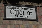
Üllői út
Üllői út

Üllői út (Üllői Avenue, lit. means "Road to Üllő", Hungarian pronunciation: [ˈylːøːji ˈuːt]) is a major transport artery in Budapest, Hungary. Üllői út is the longest avenue in Budapest. It is 15.6 km long and nearly perfectly straight. It starts at the edge of Inner City proper, crosses Small Boulevard and Grand Boulevard and runs as far as the boundary of the capital in southeastern direction, reaching the nearby towns (suburbs) of Vecsés and Üllő, the latter providing its name. During the socialist era, the avenue's name was Vörös Hadsereg útja (lit. Street of the Red Army) between Határ út (pre-1950 city limit) and the present (post-1950) city limit. See also: Greater Budapest The Metro 3 runs under it from Kálvin tér as far as Határ út, having 8 stations along it. It has a side-road leading to Ferihegy Airport, the most important international airport of Hungary. It also forms the boundary between Ferencváros and Józsefváros. Üllő means "anvil" in Hungarian. Among its notable points are Semmelweis University Museum of Applied Arts Semmelweis University Clinics Szent István Hospital and Szent László Hospital (together Üllői Avenue Clinics, the largest hospital complex in Budapest) Stadion Albert Flórián (former Üllői úti stadion/Stadion Üllői Avenue) People's Park with the central autobus station Attila József microdistrict (built 1957–1967), the first Soviet-style housing estate in Budapest Wekerletelep, a historic garden suburb built before and around WWI, named after Sándor Wekerle, its central square planned by the architect Károly Kós.