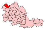
Fallings Park

Fallings Park is a suburb of Wolverhampton, West Midlands, and a ward of Wolverhampton City Council. It is situated in the northeast of the city, bordering South Staffordshire and the Wednesfield North, Heath Town, Bushbury South and Low Hill and Bushbury North wards. It forms part of the Wolverhampton North East constituency. Fallings Park ward covers over 5,000 properties in the following areas: Longknowle, Newbolds, Scotlands, Underhill, Willows. The population of the Wolverhampton Ward taken at the 2011 census was 12,410.A 50-house model housing exhibition was erected by Wolverhampton council at Fallings Park in 1908, but the planned housing estate was never completed due to the outbreak of World War I in 1914.
Excerpt from the Wikipedia article Fallings Park (License: CC BY-SA 3.0, Authors, Images).Fallings Park
Prosser Street, Wolverhampton Fallings Park
Geographical coordinates (GPS) Address Nearby Places Show on map
Geographical coordinates (GPS)
| Latitude | Longitude |
|---|---|
| N 52.6 ° | E -2.1166666666667 ° |
Address
Prosser Street
WV10 9AU Wolverhampton, Fallings Park
England, United Kingdom
Open on Google Maps


