Rancho Temecula
California ranchosRanchos of Riverside County, CaliforniaTemecula, California
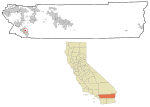
Rancho Temecula was a 26,609-acre (107.68 km2) Mexican land grant in present-day Riverside County, California given on December 14, 1844 by Governor Manuel Micheltorena to Feliz Valdez. The grant extended south along the east bank Murrieta Creek to Temecula Creek and encompassed present-day Temecula, Murrieta and Murrieta Hot Springs. At the time of the US patent, Rancho Temecula was a part of San Diego County. Riverside County was created by the California Legislature in 1893 by taking land from both San Bernardino and San Diego Counties.
Excerpt from the Wikipedia article Rancho Temecula (License: CC BY-SA 3.0, Authors).Rancho Temecula
Murrieta Murrieta Hot Springs
Geographical coordinates (GPS) Address Nearby Places Show on map
Geographical coordinates (GPS)
| Latitude | Longitude |
|---|---|
| N 33.55 ° | E -117.17 ° |
Address
92563 Murrieta, Murrieta Hot Springs
California, United States
Open on Google Maps


