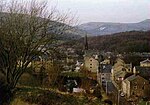
Cloughfold
Geography of the Borough of RossendaleLancashire geography stubsUse British English from March 2015Villages in Lancashire

Cloughfold is a small hamlet in between the towns of Rawtenstall and Waterfoot in Rossendale, Lancashire, England. Clough Fold railway station on the Rawtenstall to Bacup Line opened in 1871 and closed when the line closed in 1966.
Excerpt from the Wikipedia article Cloughfold (License: CC BY-SA 3.0, Authors, Images).Cloughfold
Dobbin Close, Borough of Rossendale Clough Fold
Geographical coordinates (GPS) Address Nearby Places Show on map
Geographical coordinates (GPS)
| Latitude | Longitude |
|---|---|
| N 53.701 ° | E -2.268 ° |
Address
Dobbin Close
Dobbin Close
BB4 7TH Borough of Rossendale, Clough Fold
England, United Kingdom
Open on Google Maps


