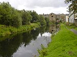
Rossendale Valley
Geography of the Borough of RossendaleMoorlands of EnglandMountains and hills of Lancashire

The Rossendale Valley is in the Rossendale area of Lancashire, England, between the West Pennine Moors and the main range of the Pennines. The area includes the steep-sided valleys of the River Irwell and its tributaries (between Rawtenstall and Bacup), which flow southwards into Greater Manchester. The rivers cut through the moorland of the Rossendale Hills, generally characterized by open unwooded land, despite the ancient designation of "forest".
Excerpt from the Wikipedia article Rossendale Valley (License: CC BY-SA 3.0, Authors, Images).Rossendale Valley
Yarraville Street, Borough of Rossendale Wood Top
Geographical coordinates (GPS) Address Nearby Places Show on map
Geographical coordinates (GPS)
| Latitude | Longitude |
|---|---|
| N 53.698 ° | E -2.281 ° |
Address
Yarraville Street
Yarraville Street
BB4 6BA Borough of Rossendale, Wood Top
England, United Kingdom
Open on Google Maps


