Fort de Charenton

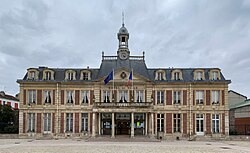
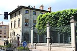
Fort de Charenton is a fortification built in 1842 in the community of Maisons-Alfort, and part of the Paris defences planned by Adolphe Thiers. After the fall of Napoleon I in 1814, and again after Napoleon's defeat at Waterloo in 1815, Paris was occupied by foreign forces. To counter new invasion and occupation, defensive works were planned. In 1841 a new fortified enclosure of Paris was proposed, becoming known as the Thiers wall after its chief proponent, prime minister Adolphe Thiers. The plan involved the construction of a new fortified wall around an expanded Paris, the Thiers wall proper, and the building of sixteen new forts a few kilometers farther out. The Fort de Charenton was planned as part of this system. Presently occupied by the National Gendarmerie, the fort saw passing regiments as well as foreign occupation forces at the time of the Franco-Prussian war of 1870 and the Second World War.
Excerpt from the Wikipedia article Fort de Charenton (License: CC BY-SA 3.0, Authors, Images).Fort de Charenton
Rue du Maréchal Maunoury, Nogent-sur-Marne
Geographical coordinates (GPS) Address Nearby Places Show on map
Geographical coordinates (GPS)
| Latitude | Longitude |
|---|---|
| N 48.808927 ° | E 2.428828 ° |
Address
Rue du Maréchal Maunoury
Rue du Maréchal Maunoury
94700 Nogent-sur-Marne, Centre Ville
Ile-de-France, France
Open on Google Maps


