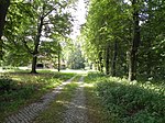
Deil (Heidmark)
Abandoned villages in Lower SaxonyHeidekreis geography stubsHeidmark
Deil was a farm in the old district (Altkreis) of Fallingbostel, located in the Heidmark region in the north German state of Lower Saxony. In 1935/36 the farm was commandeered by the barracks built in the vicinity and served as an officers mess. There were probably several farms in a village called Deil in former times. Deil Farm (Hof Deil) belonged to the parish of Bockhorn and was its largest farmstead. The last owner sold wood, but could not avoid going bankrupt.
Excerpt from the Wikipedia article Deil (Heidmark) (License: CC BY-SA 3.0, Authors).Deil (Heidmark)
A 7,
Geographical coordinates (GPS) Address Nearby Places Show on map
Geographical coordinates (GPS)
| Latitude | Longitude |
|---|---|
| N 52.84 ° | E 9.6891666666667 ° |
Address
A 7
29683
Lower Saxony, Germany
Open on Google Maps


