Osterheide
Geography of Lower SaxonyHeidmarkUnincorporated areas of Germany

Osterheide is an unincorporated area in the district of Heidekreis, in Lower Saxony, Germany. The 177.99 square kilometres (68.72 sq mi) area has 2,463 inhabitants (as at 31 December 2020). Its administrative seat is the village of Oerbke; other villages are Ostenholz and Wense. The districts of Osterheide and Lohheide cover the Bergen-Hohne Military Training Area.
Excerpt from the Wikipedia article Osterheide (License: CC BY-SA 3.0, Authors, Images).Osterheide
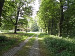
Panzerringstraße, Osterheide
Geographical coordinates (GPS) Address Nearby Places Show on map
Geographical coordinates (GPS)
| Latitude | Longitude |
|---|---|
| N 52.85 ° | E 9.7333333333333 ° |
Address
Panzerringstraße
Panzerringstraße
29683 Osterheide
Lower Saxony, Germany
Open on Google Maps


