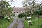
Mere, Wiltshire

Mere is a market town and civil parish in Wiltshire, England. It lies at the extreme southwestern tip of Salisbury Plain, close to the borders of Somerset and Dorset. The parish includes the hamlets of Barrow Street, Burton, Charnage, Limpers Hill, Rook Street and Southbrook. The A303 trunk road passed through Mere until a bypass was built on the northern edge of the town in 1976.There is an old market square (although markets have not been held for several years), a chiming town clock and a large 15th-century parish church. The steep slope of Castle Hill rises from the northwestern side of Mere. Local industry and commerce includes the Hill Brush company, large wholesale plant nurseries and Yapp's wine merchants.
Excerpt from the Wikipedia article Mere, Wiltshire (License: CC BY-SA 3.0, Authors, Images).Mere, Wiltshire
Salisbury Street,
Geographical coordinates (GPS) Address Nearby Places Show on map
Geographical coordinates (GPS)
| Latitude | Longitude |
|---|---|
| N 51.09 ° | E -2.266 ° |
Address
Salisbury Street
Salisbury Street
BA12 6HF
England, United Kingdom
Open on Google Maps


