Kita-ku, Okayama
Okayama geography stubsWards of Okayama

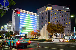
Kita-ku (北区) is one of four wards of Okayama, Okayama Prefecture, Japan. The ward has an area of 451.03 km2 and a population of 295,312. The population density is 655 per square kilometer. The name means "North Ward." The wards of Okayama were established when Okayama became a city designated by government ordinance on April 1, 2009. The city has its municipal headquarters in kita-ku. The South Korean government maintains the Korea Education Institution (Korean: 오카야마한국교육원, Japanese: 岡山韓国教育院) in Kita-ku.
Excerpt from the Wikipedia article Kita-ku, Okayama (License: CC BY-SA 3.0, Authors, Images).Kita-ku, Okayama
Okayama North Ward
Geographical coordinates (GPS) Address Phone number Website Nearby Places Show on map
 Continue reading on Wikipedia
 Geographical coordinates (GPS)
| Latitude | Longitude |
|---|---|
| N 34.655 ° | E 133.91944444444 ° |
Address
岡山市役所
1番1号
700-8544 Okayama, North Ward
Japan
Open on Google Maps
Phone number
Website
city.okayama.jp