Kungsholmen
Districts of StockholmIslands of MälarenIslands of Stockholm

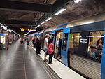
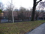
Kungsholmen is an island in Lake Mälaren in Sweden, part of central Stockholm, Sweden. It is situated north of Riddarfjärden and considered part of the historical province Uppland. Its area is 3.9 km2 (1.5 sq mi) with a perimeter of 8.9 km (5.5 mi). The highest point is at Stadshagsplan at 47 metres (154 ft). The total population is 71,542 (December 31, 2020).Administratively, it is subdivided into the five districts Kungsholmen, Marieberg, Fredhäll, Kristineberg and Stadshagen.
Excerpt from the Wikipedia article Kungsholmen (License: CC BY-SA 3.0, Authors, Images).Kungsholmen
Sankt Göransgatan, Stockholm Kungsholmen (Kungsholmens stadsdelsområde)
Geographical coordinates (GPS) Address Nearby Places Show on map
Geographical coordinates (GPS)
| Latitude | Longitude |
|---|---|
| N 59.333333333333 ° | E 18.033333333333 ° |
Address
Sankt Göransgatan 62
112 33 Stockholm, Kungsholmen (Kungsholmens stadsdelsområde)
Sweden
Open on Google Maps


