Fintry Hills
Hills of the Scottish Midland ValleyMountain ranges of ScotlandMountains and hills of Stirling (council area)

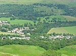
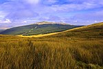
The Fintry Hills form the western end of a range of hills which stretch west from the city of Stirling, Scotland. They culminate in the 511-metre (1,677 ft) peak of Stronend, which overlooks Strathendrick and the village of Fintry. The northern, western and southern sides of the hills are defined by a steep and craggy escarpment, whilst the eastern sides run more gently down into the valley of the Backside Burn and Endrick Water. The Boquhan Burn, which runs initially northeastwards, drops over the northern scarp at the Spout of Ballochleam. Loch Walton lies at the foot of the hills’ southern slopes.
Excerpt from the Wikipedia article Fintry Hills (License: CC BY-SA 3.0, Authors, Images).Fintry Hills
Geographical coordinates (GPS) Address Nearby Places Show on map
Geographical coordinates (GPS)
| Latitude | Longitude |
|---|---|
| N 56.071 ° | E -4.167 ° |
Address
FINTRY HILLS
G63 0XQ
Scotland, United Kingdom
Open on Google Maps


