Millington, Cheshire

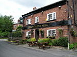
Millington is a former civil parish, now in the parishes of Millington and Rostherne and Little Bollington with Agden, in the Cheshire East district, in the ceremonial county of Cheshire, England. The parish was 8 miles (13 km) from Warrington and 3 miles (5 km) from Altrincham. Its name is a "relic of Saxon clanship – the ton or town of the Millings". The parish is primarily agricultural, with a number of farms including Moss House Farm, Newhall Farm, Mereside Farm, Boothbank Farm and Stonedelph Farm. Millington has been recently described on Britain Streets as a "hamlet or isolated settlement in the inhabited countryside". Millington is situated within the market town Macclesfield. The M56 motorway was close to the parish, which allows travel into areas of Warrington and Manchester, 13 miles (21 km) and 14 miles (23 km) away respectively. In 2011 the parish had a population of 234.
Excerpt from the Wikipedia article Millington, Cheshire (License: CC BY-SA 3.0, Authors, Images).Millington, Cheshire
Millington Lane,
Geographical coordinates (GPS) Address Nearby Places Show on map
Geographical coordinates (GPS)
| Latitude | Longitude |
|---|---|
| N 53.358 ° | E -2.41 ° |
Address
Millington Lane
Millington Lane
WA14 3RR , Millington and Rostherne
England, United Kingdom
Open on Google Maps


