Rancho Punta de Pinos
1833 establishments in Alta CaliforniaCalifornia ranchosRanchos of Monterey County, California

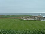
Rancho Punta de los Piños was a 2,667-acre (10.79 km2) Mexican land grant in present-day Monterey County, California given in 1833 by Governor José Figueroa to José María Armenta, and regranted to José Abrego in 1844 by Governor Manuel Micheltorena. The name means "Point of the Pines". The grant extended along the Pacific coast from Point Piños near Pacific Grove south to Rancho Pescadero.
Excerpt from the Wikipedia article Rancho Punta de Pinos (License: CC BY-SA 3.0, Authors, Images).Rancho Punta de Pinos
17 Mile Drive,
Geographical coordinates (GPS) Address Phone number Website Nearby Places Show on map
Geographical coordinates (GPS)
| Latitude | Longitude |
|---|---|
| N 36.61 ° | E -121.94 ° |
Address
The Links at Spanish Bay
17 Mile Drive 2700
93953
California, United States
Open on Google Maps


