Red River Floodway

The Red River Floodway (French: Canal de dérivation de la rivière Rouge) is an artificial flood control waterway in Western Canada. It is a 47 km (29 mi) long channel which, during flood periods, takes part of the Red River's flow around the city of Winnipeg, Manitoba to the east and discharges it back into the Red River below the dam at Lockport. It can carry floodwater at a rate of up to 140,000 cubic feet per second (4,000 m3/s), expanded in the 2000s from its original channel capacity of 90,000 cubic feet per second (2,500 m3/s). The Floodway was pejoratively nicknamed Duff's Ditch by opponents of its construction, after Premier Duff Roblin, whose Progressive Conservative government initiated the project, partly in response to the disastrous 1950 Red River flood. It was completed in time and under budget. Subsequent events have vindicated the plan, leading to the nickname becoming an affectionate one. Since its completion in 1968, the Floodway is estimated to have prevented over $40 billion in cumulative flood damage. It was designated a National Historic Site of Canada in 2000, as the floodway is an outstanding engineering achievement both in terms of function and impact. From south to north, the Floodway passes through the extreme southeastern part of Winnipeg and the rural municipalities of Ritchot, Springfield, East St. Paul, and St. Clements.
Excerpt from the Wikipedia article Red River Floodway (License: CC BY-SA 3.0, Authors, Images).Red River Floodway
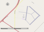
Henderson Highway,
Geographical coordinates (GPS) Address Nearby Places Show on map
 Continue reading on Wikipedia
 Geographical coordinates (GPS)
| Latitude | Longitude |
|---|---|
| N 50.090005 ° | E -96.934079 ° |
Address
Henderson Highway
Henderson Highway
R1A 3H6
Manitoba, Canada
Open on Google Maps