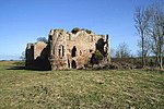
Ladykirk, Scottish Borders
Villages in the Scottish Borders
Ladykirk is a village on the B6470 in the Scottish Borders area of Scotland, and the former Berwickshire, just north of the River Tweed and the Anglo-Scottish border. The town was formerly known as Upsettlington, but King James IV of Scotland renamed the town Ladykirk; the church is also known as St Mary's Church or Kirk of Steill. Ladykirk stands directly opposite Norham Castle, Northumberland, England
Excerpt from the Wikipedia article Ladykirk, Scottish Borders (License: CC BY-SA 3.0, Authors).Ladykirk, Scottish Borders
Geographical coordinates (GPS) Address Nearby Places Show on map
Geographical coordinates (GPS)
| Latitude | Longitude |
|---|---|
| N 55.716666666667 ° | E -2.1833333333333 ° |
Address
TD15 1SU
Scotland, United Kingdom
Open on Google Maps


