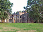
Bowling and Barkerend
Wards of Bradford

Bowling and Barkerend is an electoral ward within the City of Bradford Metropolitan District Council. The population at the 2011 Census was 20,618.Bowling and Barkerend covers the area immediately east and south of Bradford centre. It includes the areas known as Barkerend, Bowling, East Bowling, Swaine Green, Cutler Heights and Goose Hill. St Clement's Church on Barkerend Road has Pre-Raphaelite decorations by Sir Edward Burne-Jones. Note that West Bowling is in neighbouring Little Horton ward.
Excerpt from the Wikipedia article Bowling and Barkerend (License: CC BY-SA 3.0, Authors, Images).Bowling and Barkerend
St George's Place, Bradford West Bowling
Geographical coordinates (GPS) Address Phone number Nearby Places Show on map
Geographical coordinates (GPS)
| Latitude | Longitude |
|---|---|
| N 53.783 ° | E -1.733 ° |
Address
HSS Hire
St George's Place
BD4 7LX Bradford, West Bowling
England, United Kingdom
Open on Google Maps


