Kaiserstuhl (Baden-Württemberg)
Extinct volcanoes of EuropeHill ranges of GermanyLandforms of Baden-WürttembergPages including recorded pronunciationsPages with German IPA ... and 3 more
Volcanic groupsVolcanoes of GermanyWine regions of Germany

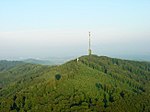
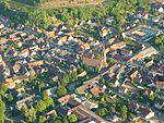
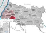
The Kaiserstuhl (German: [ˈkaɪzɐʃtuːl] , lit. "Emperor’s Chair") is a range of hills in the state of Baden-Württemberg in southwest Germany with a maximum height of 556.6 metres (1,826 ft). It is of volcanic origin and located in the southwest of the state in the counties of Emmendingen and Breisgau-Hochschwarzwald. In terms of natural regions it is considered to be a part of the Upper Rhine Plain.
Excerpt from the Wikipedia article Kaiserstuhl (Baden-Württemberg) (License: CC BY-SA 3.0, Authors, Images).Kaiserstuhl (Baden-Württemberg)
Neunlindenstraße, VVG der Stadt Breisach am Rhein
Geographical coordinates (GPS) Address Nearby Places Show on map
Geographical coordinates (GPS)
| Latitude | Longitude |
|---|---|
| N 48.08083 ° | E 7.67056 ° |
Address
Beim Neunlindenturm
Neunlindenstraße
79241 VVG der Stadt Breisach am Rhein, Ihringen (Kernort)
Baden-Württemberg, Germany
Open on Google Maps
